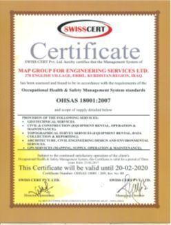
18001:2007(certificate)
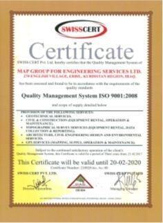
ISO 9001 2008 (certificate)
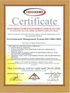
ISO 14001 2004 (certificate)
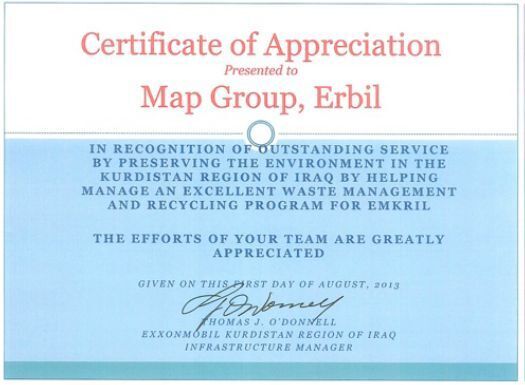
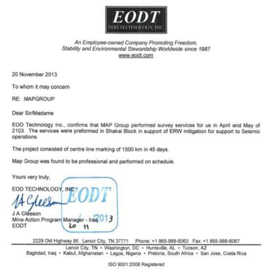
Exxon Mobil (appreciation letter)
Data Recovery (certificate)
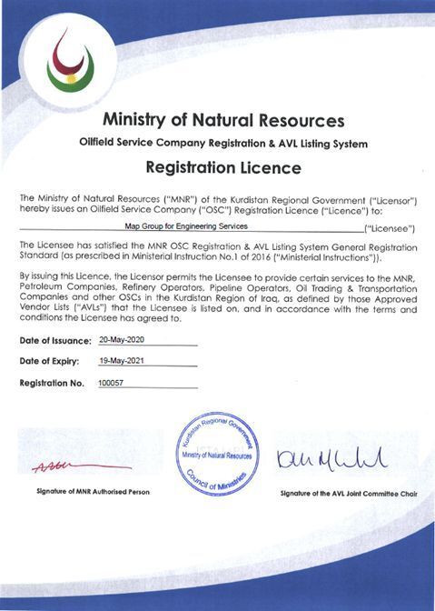
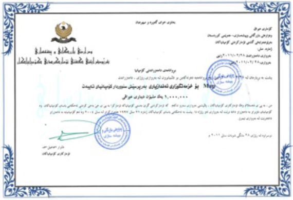
KRG-MNR business registration number (certificate)
ISO 14001 2004 (certificate)
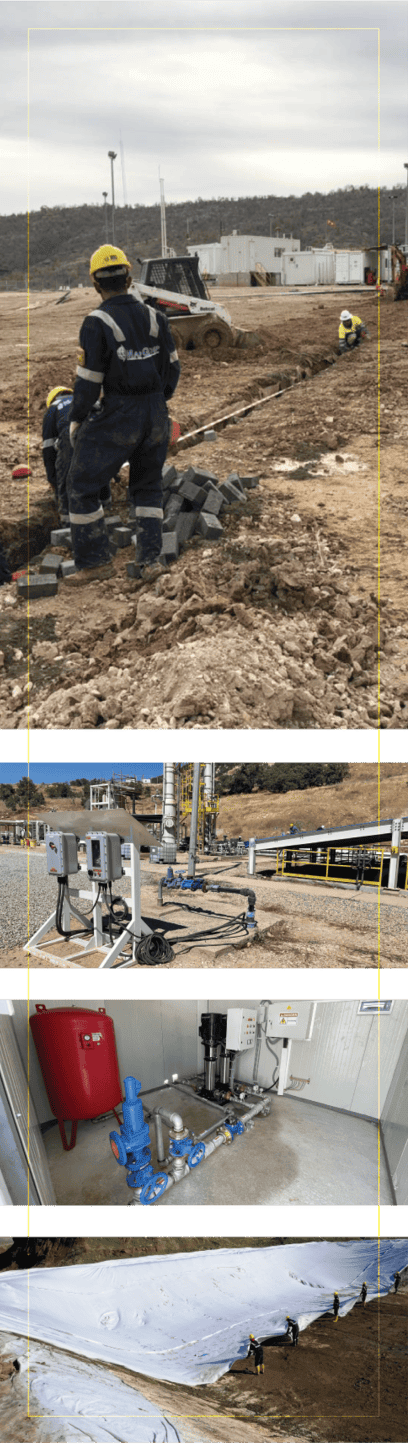
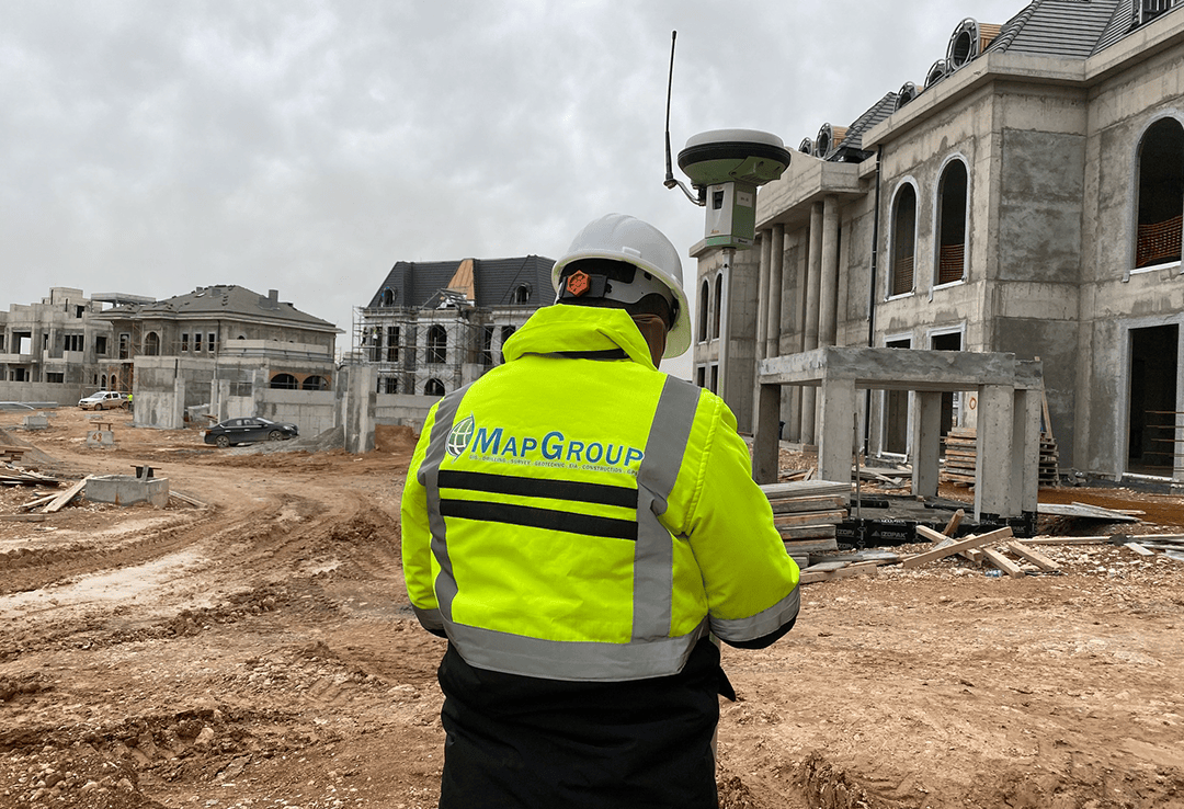
Ard Ltd. has successfully completed construction projects in collaboration with both international and regional partners. Our Construction Department ensures that all work is executed to the highest standards, on time and within budget. From initial planning to final delivery, we maintain strong quality control and stakeholder communication. Every project reflects our commitment to precision and reliability.
![]()
Turnkey construction management.
![]()
Coordination with local and global firms.
![]()
Quality controlled planning
and execution.
![]()
Budget and schedule accountability.
![]()
Integration with design and engineering teams.
![]()
Adherence to local codes and international standards.
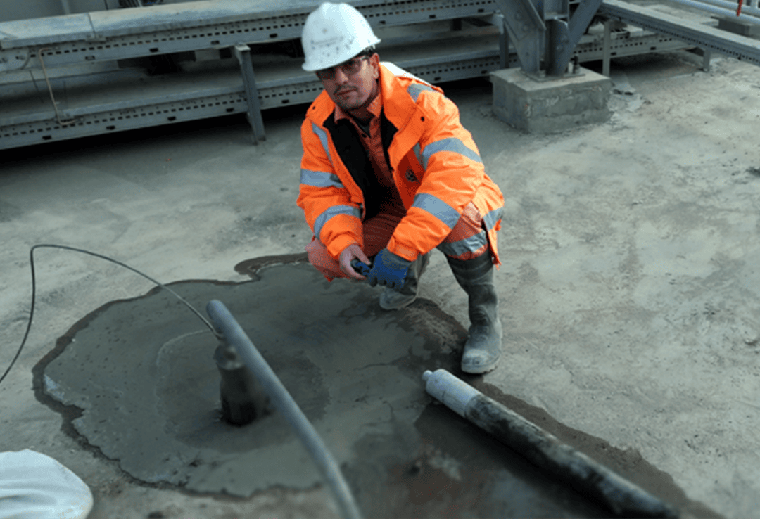
Following years of expertise, Ard Ltd. provide advanced foundation treatment using specialized grouting techniques to improve ground conditions. Grouting involves injecting materials into soil or rock to enhance strength, reduce permeability, and control groundwater during construction. Our methods are ideal for complex terrain or challenging environmental conditions. Every solution is designed to ensure stability and structural safety.
Grouting is an essential part of our foundation and underground works offering. We offer a range of grouting materials suited to different engineering requirements. From cement-based to chemical grouts, our services adapt to soil type, load capacity, and water pressure. The experienced team designated for grouting services will implement each system with precision and quality assurance.
![]()
Foundation stabilization and sealing.
![]()
Cement, bentonite, chemical, resin grouting.
![]()
Groundwater control during construction.
![]()
Soil improvement in high-permeability zones.
![]()
Bituminous grouting for specialized cases.
![]()
Tailored treatment based on site conditions.
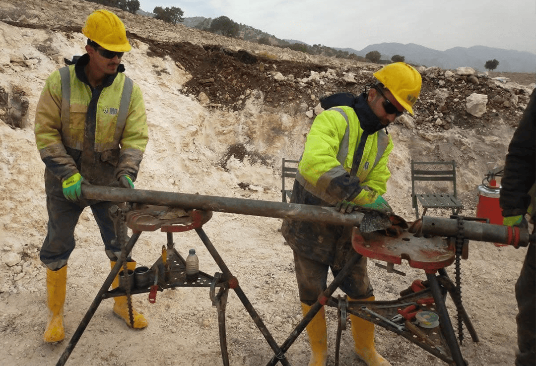
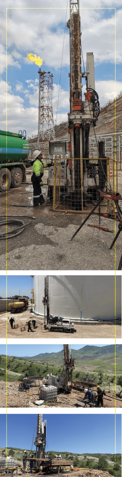
We offer turnkey drilling solutions for water resources, geotechnical analysis, and energy exploration. Our teams use advanced air-system technologies and site-specific techniques to serve diverse client needs across Kurdistan and Iraq. We manage the full drilling lifecycle, from site investigation to long-term well maintenance. Every project is executed with safety, precision, and efficiency.
Our capabilities include water wells, dewatering, geothermal, and pile drilling across varying diameters. We handle casing, screening, and development with specialized cleaning tools and wireline coring. Clients trust our comprehensive drilling services to support sustainable and technically sound infrastructure development. All operations are performed with strict adherence to safety standards and regional environmental regulations.
Water-well and dewatering well drilling.
Thermal and geothermal well solutions.
Pile drilling and structural boreholes
Wireline coring and well
rehabilitation.
Air/steam cleaning and development
Casing, screening, and long-term maintenance.
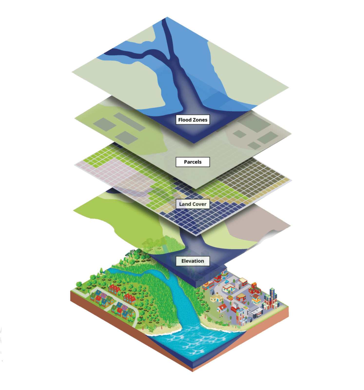
Customized mapping for local and overseas clients.
Topographic map creation in multiple scales.
Certified ESRI instruction and GIS software training.
Integration with enterprise-wide and legacy data systems.
GIS support for infrastructure and planning projects.
Creator of Kurdistan’s first full-region map book.
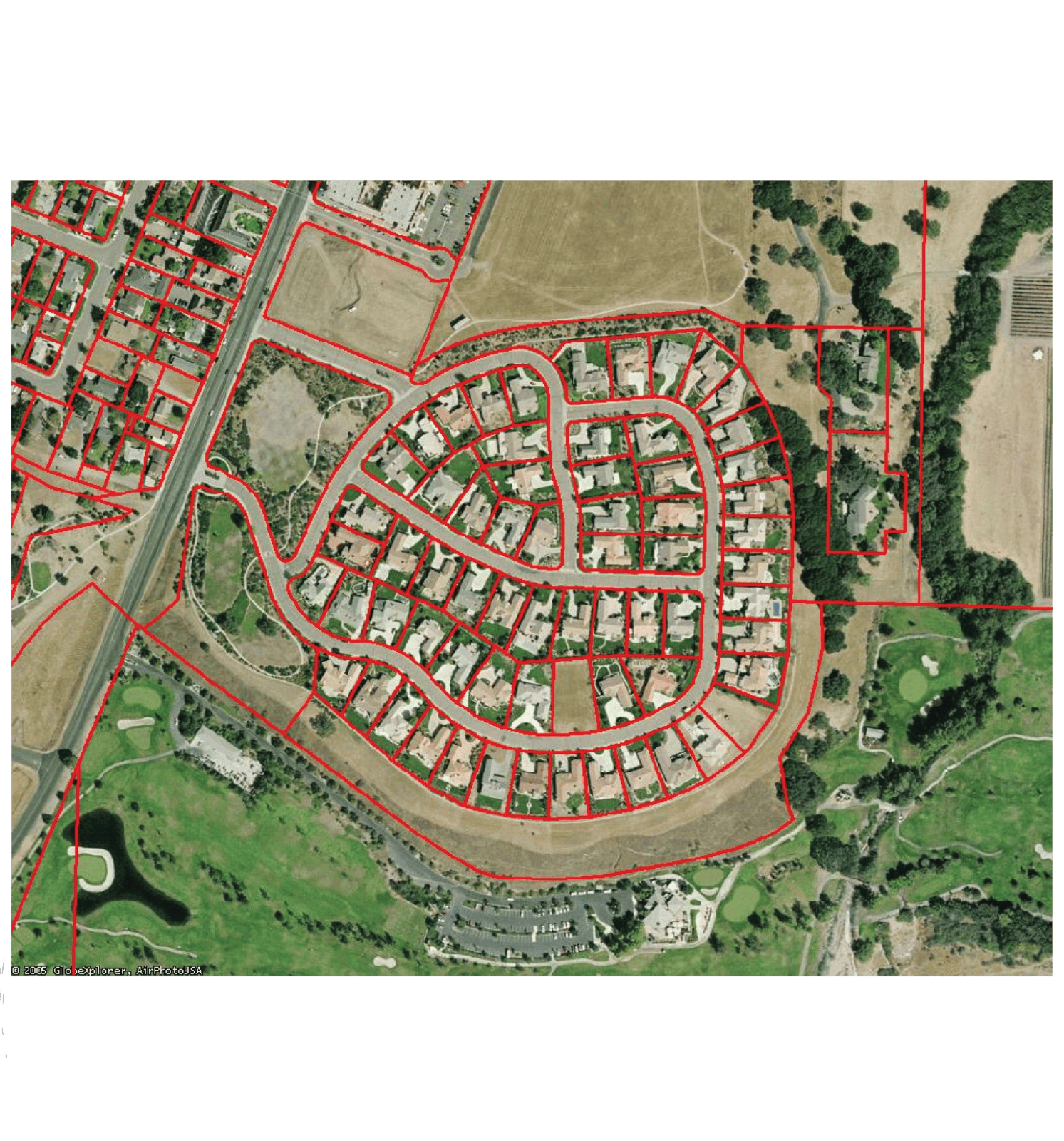
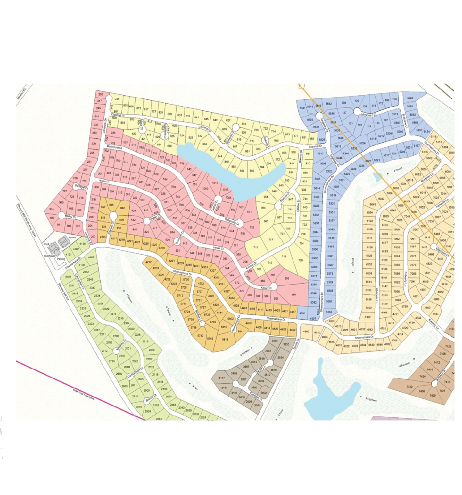
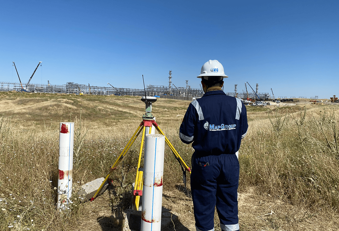
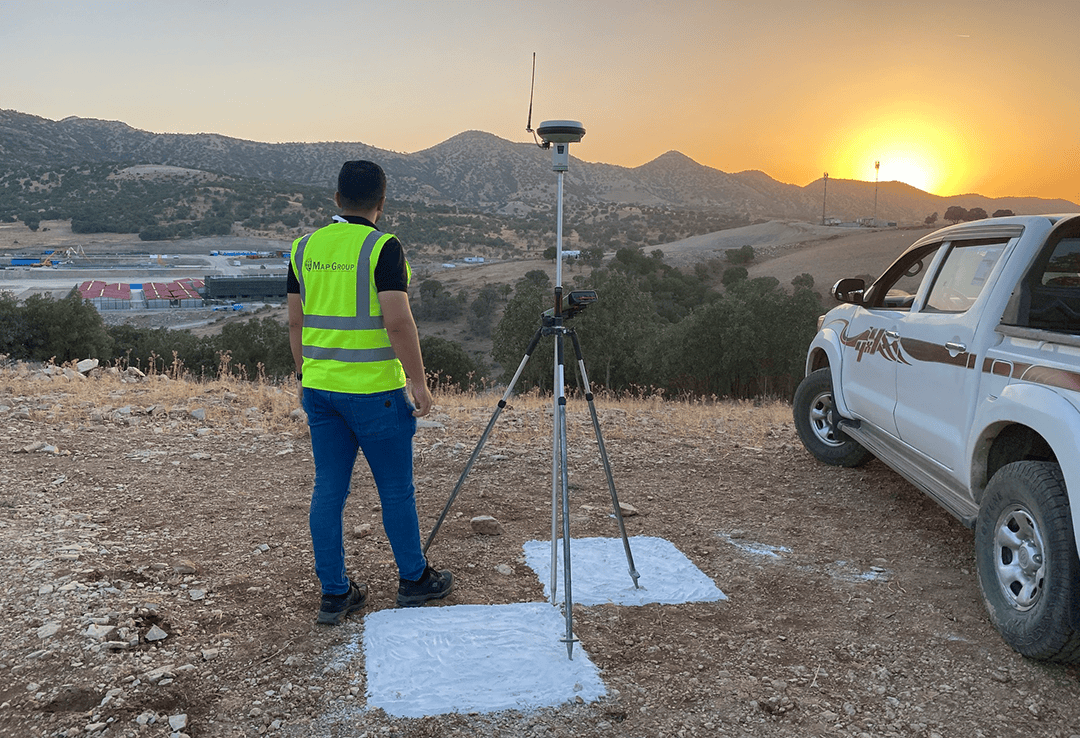
Since 2006, Ard Ltd. has offered comprehensive land and utility survey services across challenging environments. Our skilled team performs precise surveying for infrastructure, utilities, and land development using both traditional and modern techniques. Clients will aptly benefit from accurate data, rapid deployment, and reliable reporting. We ensure compliance, efficiency, and safety at every stage.
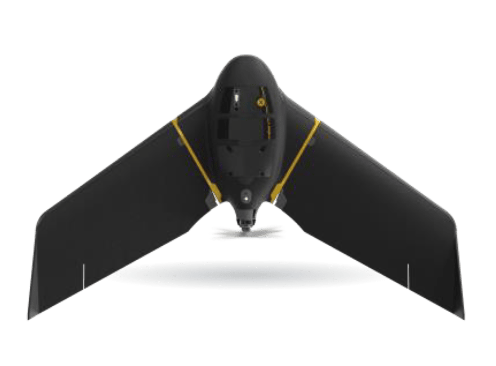
The capabilities we provide include drone-based aerial surveys, underground detection, and geodetic mapping, by use of various avenues of surveying systems tailored to fit the project’s needs. From road alignments to boundary demarcation, we cover the full range of surveying needs. We specialize in high-risk zones and complex terrain, supporting large-scale projects with dependable geospatial insights.
![]()
Aerial surveying using drones
(eBee RTK) .
![]()
Topographic and cadastral surveys.
![]()
Hydrographic and quantity surveying.
![]()
Hazard zone and structural monitoring.
![]()
Underground utility surveys (GPR, radio detection).

Route design and volumetric calculations.
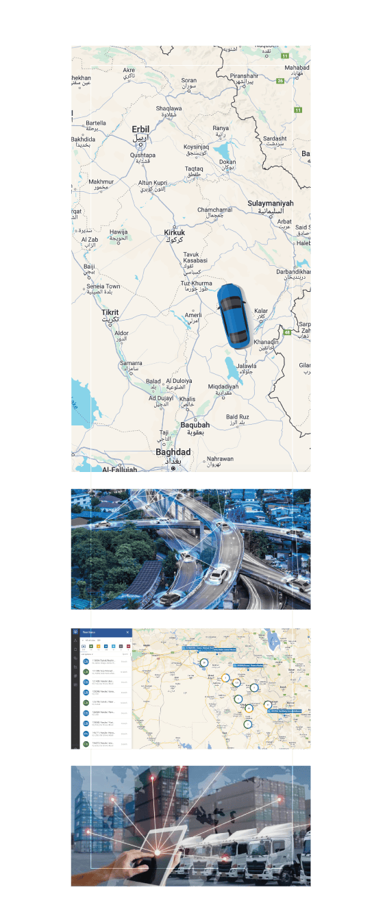
ARD Ltd. provides advanced GPS tracking and fleet monitoring solutions for both personal and commercial use. In partnership with Ruptela since 2016, we deliver reliable systems tailored to logistics, construction, and field operations. Our platform enables real-time monitoring and route optimization with cross-device compatibility. Clients gain control, security, and operational visibility through a single integrated interface.
We extend solutions for driver behavior analysis, geofencing, and task management with alert systems and API access. Our tools empower businesses to monitor operations remotely and respond quickly to field conditions. Whether managing a fleet or tracking assets, our GPS services provide critical insights to improve efficiency. The system works seamlessly across PC, smartphone, and tablet platforms.
![]()
Real-time GPS tracking and trip history reports.
![]()
Remote configuration and route management.
![]()
Driver ID and direct communication tools.
![]()
Geofencing, alerts, and eco-driving analysis.
![]()
Cross-platform (PC, tablet, mobile) access.
![]()
API integration and Garmin functionality.
Why eBee Drones?

Easy to use
Intuitive flight planning,hand-launched andautomated operation

Robust & reliable
Designed to operate inharsh terrains

Portable
Easy-to-carry backpack to safelystore and transport equipment

Simplified maintenance
Modular design for fast accessory swaps and in-field repairs.
![]()
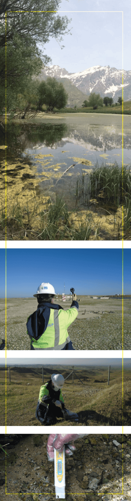
Environmental Impact Assessments (EIA & ESHIA).
![]()
Environmental Baseline
Studies (EBS) .
![]()
Routine environmental and air quality monitoring.
![]()
Waste and water management consultations.
![]()
Risk and hazard assessments.
![]()
Socio-economic and site-specific surveys.
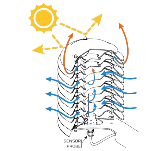
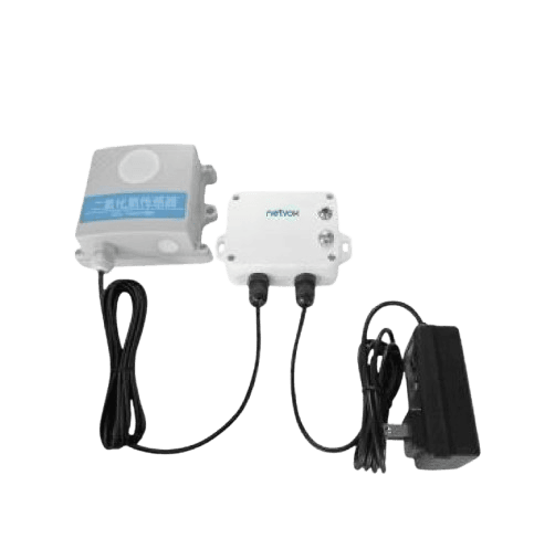
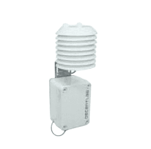
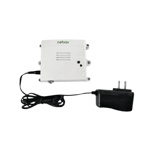
Ard Ltd. offers real-time air quality monitoring using advanced LoRaWAN-enabled sensor systems. These devices detect harmful gases and airborne pollutants to ensure safety and environmental compliance. Data is transmitted through secure networks for centralized analysis and early warning alerts. Our partnership with Time-Net/Teknykar bundles our system with a web-based monitoring hub designed and tweaked to the specificities of our clients.
![]()
Expansive fleet of wireless sensors.
![]()
Real-time alerts for critical air quality thresholds.
![]()
LoRaWAN integration for secure, low-power networking.
![]()
Wireless and compact array of sensors suitable for harsh environments.
![]()
Gateway-to-dashboard monitoring and analytics.
![]()
Supports industrial, urban, and remote locations.
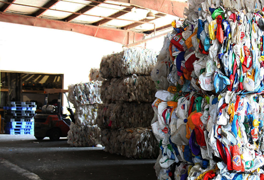
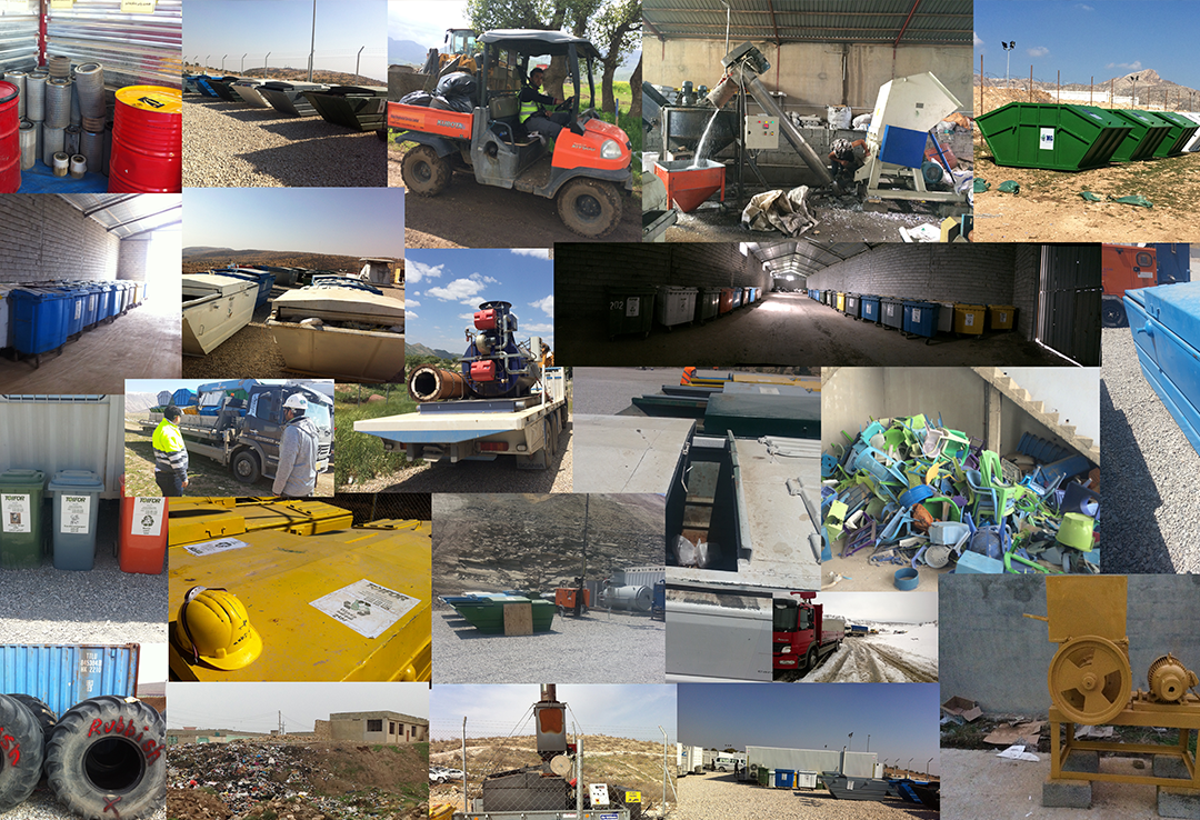
Waste Management Plan (WMP) preparation.
Transportation, disposal, and recycling services.
Solid, liquid, and hazardous waste handling.
GPS tracking and full service documentation.
Waste containers and facility support.
On-site monitoring and regulatory compliance.
![]()
Vertical borehole drilling and soil sampling.
![]()
Standard Penetration Test (SPT) and CPT services.
![]()
Plate load and seismic surveys.
![]()
2D resistivity surveys and test pit excavation.
![]()
Bearing and settlement analysis.
![]()
Foundation and slope stability assessments.
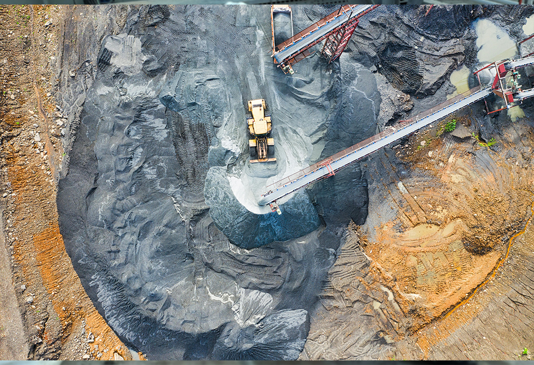
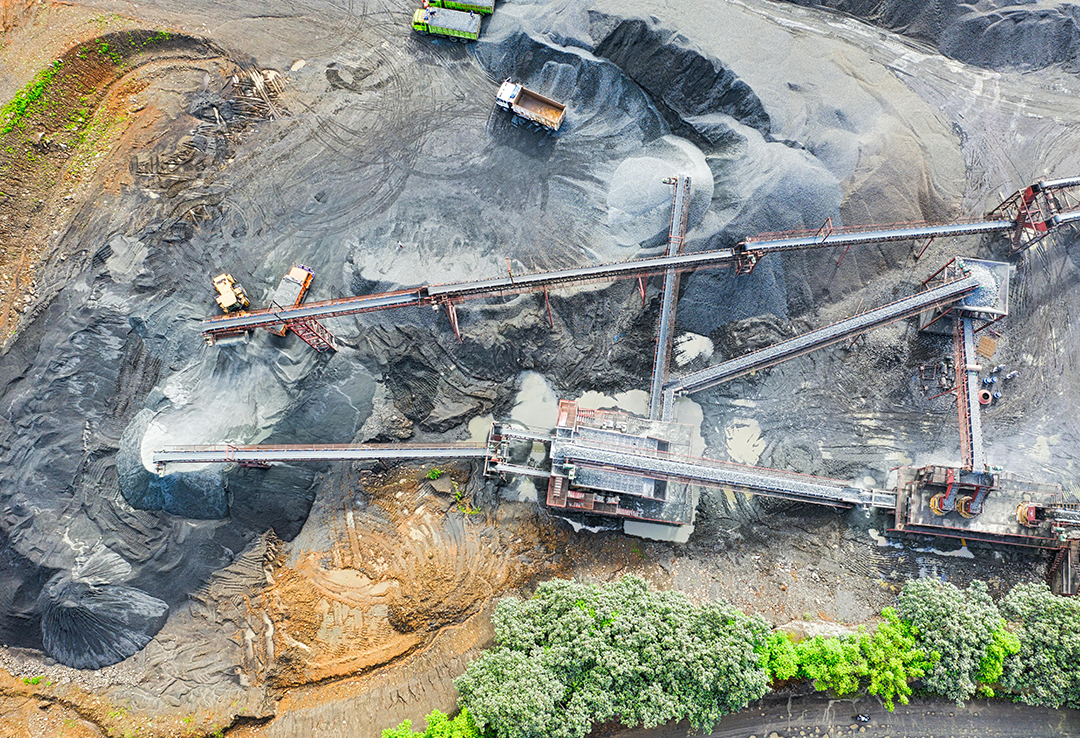
We conduct detailed laboratory analysis, reserve estimation, and borehole assessments to ensure data accuracy. By calculating true thickness and raw mix ratios, we provide clear, actionable insights for processing and production. Clients benefit from reliable evaluations aligned with long-term development goals. Every study is backed by expert interpretation and comprehensive technical reporting.
![]()
Mineral sourcing for construction and industrial use.
![]()
Geological reserve estimation and modeling.
![]()
True thickness and raw mix ratio calculations.
![]()
Full laboratory testing and reporting.
![]()
Borehole mapping and material classification.
![]()
Exploration and detailed site investigation reports.